Geography is often seen as a subject full of maps, coordinates, and theories. But what happens when students are given the chance to turn those concepts into something visual, creative, and alive? That’s exactly what senior high school students discovered through their latest project.
Instead of simply memorizing definitions, they explored the Konsep Lokasi and Konsep Nilai Kegunaan by designing colorful posters that connect geography to real life. The results were impressive bright visuals, clear explanations, and creative examples that made complex ideas easy to understand.
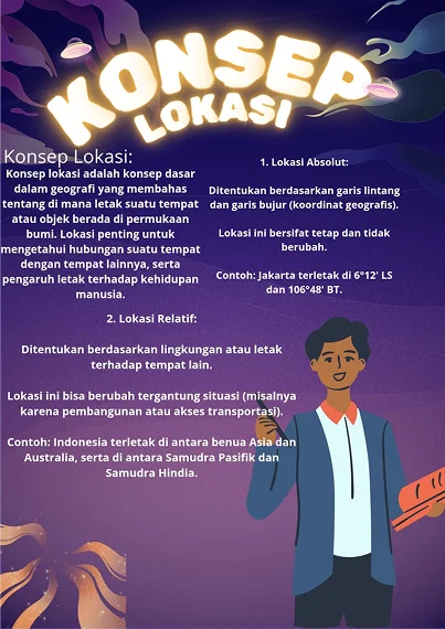
In the Konsep Lokasi project, students showed how every place on Earth can be described through absolute location (like Jakarta’s coordinates) or relative location (like Indonesia’s position between two continents and two oceans). Suddenly, location wasn’t just about numbers on a map, it became about understanding how places connect and why they matter.
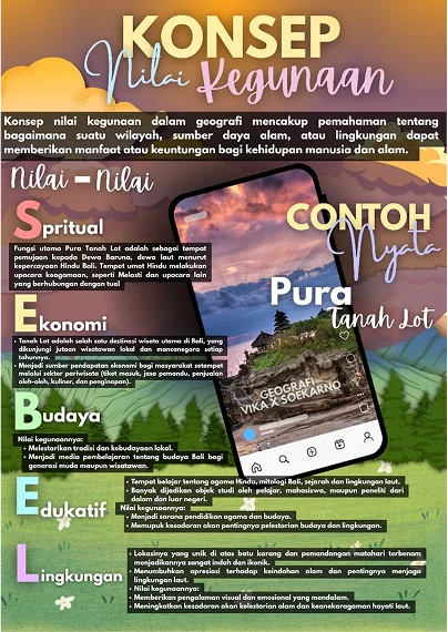
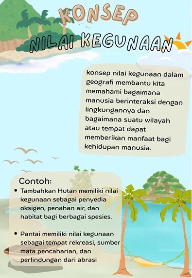
Meanwhile, the Konsep Nilai Kegunaan posters revealed just how valuable our environment is. From forests that provide oxygen and water to beaches that offer recreation and livelihoods, students highlighted the many ways nature supports human life. Some even went further, showcasing the famous Tanah Lot Temple in Bali, explaining its spiritual, cultural, economic, educational, and environmental importance.
What makes this project truly special is not only the knowledge gained, but also the skills sharpened. Students practiced teamwork, critical thinking, and digital design while turning geography into a story worth sharing. Their posters prove that learning doesn’t have to be dry it can be creative, inspiring, and deeply connected to the world we live in.
In the end, this project wasn’t just about geography. It was about seeing knowledge as something living, something that shapes how we understand our planet and our place in it. And perhaps the biggest lesson of all: learning can be as exciting as the stories we create from it.